The FAA or Federal Aviation Administration, the governing body which regulates civil aviation. This includes traffic control, certification and standards.
Take Flight, AirMap by DroneUp
AirMap for Drones, Setup and Flight App

Tech | Tools – Fly With Confidence – Airmaps
Get FAA approval to fly with AirMap by DroneUp… Are you looking for FAA compliant drone flight apps? Airmap makes flying easy and understandable. Fly with confidence while staying within legal requirements and having the knowledge to fly approved.
From installation to usage, AirMap by DroneUp for iOS or Airmap – for Android will help you understand what is happening in the airspace above you, how to fly with approved FAA flight status, log your flights, and more.
Airmaps iOS And Android

TFR

Welcome

Connect

FAA Plan

Zones

Search

Restrictions

Brevard County

Log In
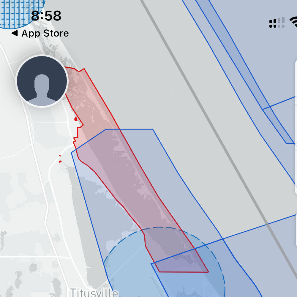
From t’s & c’s, to maps, flight logs and FAA approval to fly safely, make sure th get approved with FAA-approved flight requests. Check Kennedy Space Center to learn about the airspace above and around Kennedy. Familiarize yourself with the warnings and requirements, as well as the maps and flight restriction in and around the areas within your airspace.
Need more flight apps, or drone apps for flight approval? Leave us a comment below and we will find some additional drone apps for you. While you’re here take a look at other FAA related articles, FAA Hurricane Update from 10/1 and FAA Drone Safety from 4/19. Although these articles are now archived, it’s important to remember that drone flight rules are drone rules. Most importantly, make sure to stay compliant and safe while flying.
Materials – FAA Hurricane Update
Know What To Do Pre/Post Hurricane Ian – Before you fly, understand the current conditions in the sky above you… FAA Hurricane Update. Remember, the drone industry is constantly evolving, growing and maturing.
Drone enthusiasts will always want to fly, so be sure to prioritize safety. This year, the FAA has organized a safety awareness day for drone pilots, federal representatives, educators, drone hobbyists and more… On June 18, 2022, join your fellow drone pilots for FAA Drone Safety Day. To participate – look for ‘about drone day’, support, or host an event. This message is in reference to FAA notice number” NOTC2405. For those seeking more information or a drone piloting app, consider trying Airmaps.
For those of you who are interested in learning more about open FAA communications, licensed drone updates etc. feel free to reach out to us or leave a comment below.
FAA Drone Safety Update, Flight Over People And Flight At Night
Flight Awareness, Times and Resources Now Available

Materials – Flight At Night
FAA Drone Safety Update – Notice Number: NOTC1758
FAA Drone Safety Update it’s time for some training for you Part 107 license holders. What about the waivers? The waiver deadline is April 21, 2021, so please make note of that date. Requirements for flight at night and/or over people, moving vehicles still require FAA waivers that date. Moving forward, waivers and requirements will need additional information, especially for flights over people and/or at night.
My assumption, after speaking with the FAA, is that the traditional licensing examination and process will change. It is likely that licensing for unmanned aircraft will be more similar to the boating license process in Florida. This may involve a classroom environment, quizzes, and tests on practical knowledge and safe flying. Let’ wait and see what updates and regs. are implemented. I am not comfortable speculating on the matter, how they will happen and when. You can be the judge!
Side note, FAA Drone Safety Updates are on going, so continue to use and test Airmaps for the latest updates. As described on Airmaps some forum responses were lost in the purge due to a spammer attack. It will help you stay informed about regulations and rule updates.
FAA Drone Update

B4UFly

DroneZone
Check out the FAA’s Low Altitude Authorization and Notification Capability (LAANC) B4UFLY App, FAA DroneZone or give the FAA a call or email for clarification. It’s pretty straight-forward. As always, feel free to leave a comment below and let us know what you’re thing! Fairly straight forward. As usual leave a comment below, let us know what you’re thinking?
Venice Airfield Bound
Drone and RC Airfield

Lab Work – PH4V2 Gimbal
Airfield Bound – PH4V2 FIXED
Fixed Gimbal, freshly removed from the DJI packaging and repacked in the field case. Off to the club airfield in Venice… We are off to fly the drones! Re-posted.
Fresh Upgrade

Refreshed
It’s nice to see the drone back in working order, taking to the sky. Two, completed the requirements to fly professionally, completing and passing FAA 108 test for Part 108 Licensing. Must do, if you plan to fly professionally, beyond a hobbyist, or to take in an income based on flight. In the meantime, let’s get the drone up and push it through its paces…
Those of you who are interested in videography and flying drones, check out the drone shot article below. I don’t normally call out manufactures content or help videos, however, added a few drone shots, The Reveal, Panning, Orbit and Overhead Flight. DJI has nice article on drone shots, and how you might incorporate those shots into your flying arsenal. For more Airfield Bound articles or information on the gimbal issues, or other airfield flight tests, learn more.
As usual leave a comment below, let us know what you’re thinking?


